
By Kim Anderson
NANUET, NY – Torrential rain battered Rockland County Monday evening, unleashing flash flooding across Nanuet, Spring Valley, Monsey and neighboring towns, prompting the National Weather Service (NWS) to issue a dire warning and emergency advisories as floodwaters inundated streets, basements, and low-lying areas.
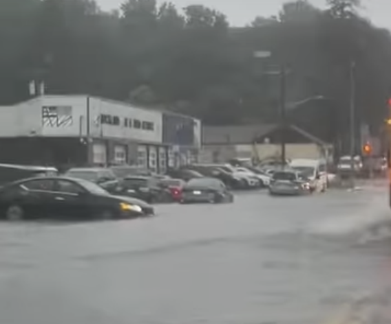
In Nanuet, cars were seen partially submerged, and in several instances required emergency services to safely extract passengers. Power outages reached into Orangetown, with several businesses reporting lights and internet service unavailable.
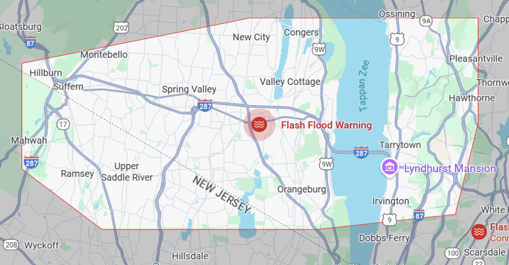
The NWS had prior issued a Flash Flood Warning for Rockland County and parts of northeastern New Jersey and central Westchester, citing rainfall totals between 4 and 5 inches in some areas, with localized downpours reaching up to 3 inches per hour. The warning remains in effect until 9:30 p.m.
“This is a dangerous and life-threatening situation,” the alert stated. “Move to higher ground now. Do not attempt to travel unless you are fleeing an area subject to flooding or under an evacuation order.”

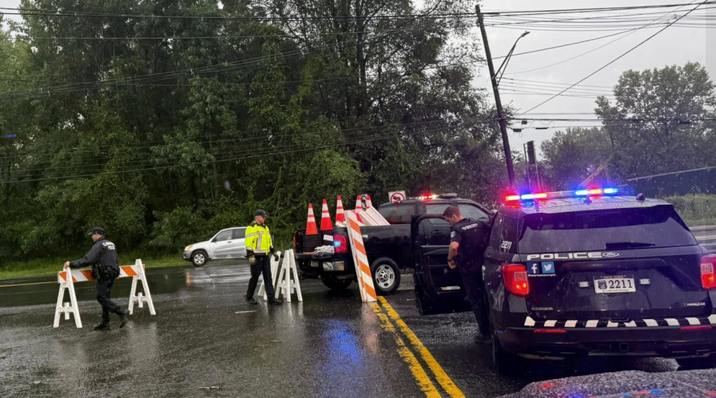
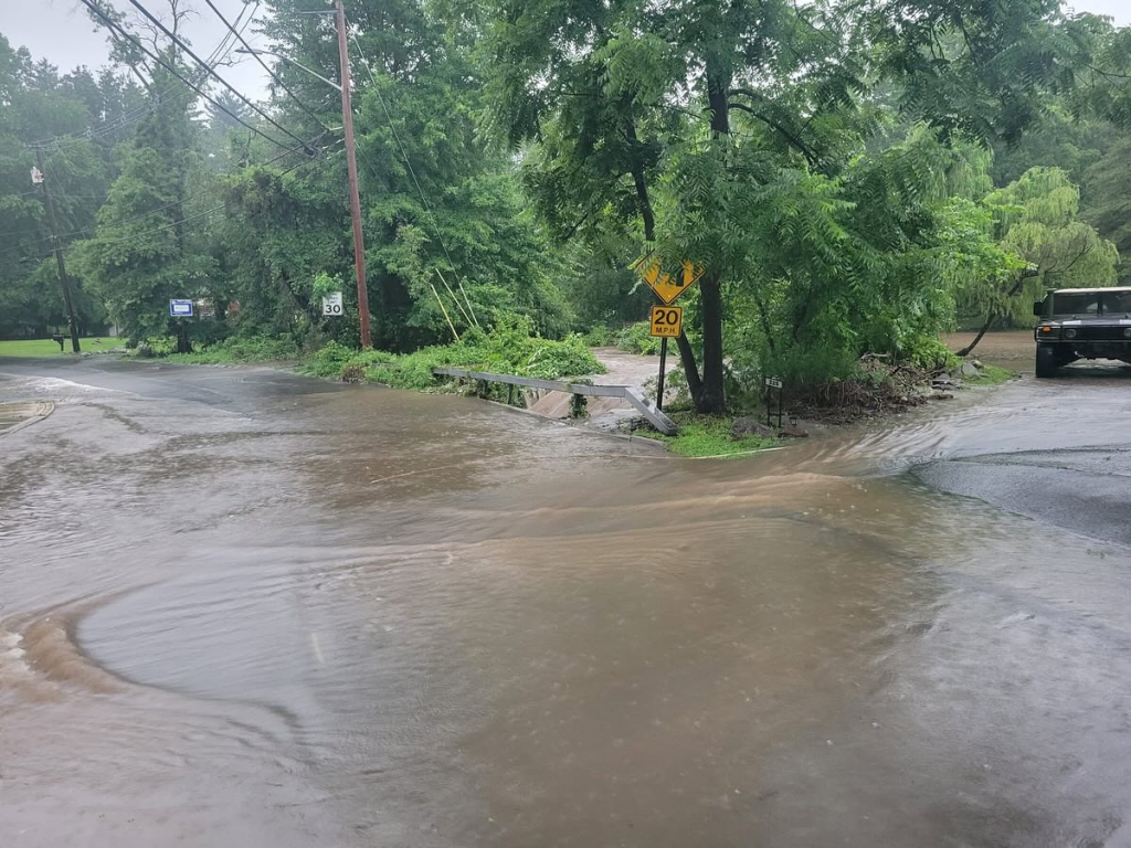
Nanuet was among the hardest-hit communities, with flooding reported in several residential neighborhoods, commercial areas, and along Route 59. Local law enforcement confirmed that flash flooding was ongoing as of 7:30 p.m., disrupting transportation, stranding vehicles, and causing severe water damage to infrastructure. Rockland Facebook and Reddit Community Groups posted pictures of downed trees and power lines across the County.
Clarkstown Police reported that Strawtown Rd at Old Mill Rd is closed in both directions due to a large tree blocking the roadway.
Residents reported flooded basements and overwhelmed drainage systems. Emergency responders were seen assisting stranded motorists and issuing advisories for residents to avoid travel. Some homes and businesses experienced water on first floors, and several underpasses were rendered impassable.

The Nanuet Library reported flooding in several parts of the building. The facility, which recently received a grant for sizable renovations – had in recent years encountered several floods, power outages and other issues within the highly-utilized building.
Officials encourage residents to follow safety protocols: “Turn around, don’t drown,” the NWS reminded. “Most flood deaths occur in vehicles.”
The National Weather Service warned that isolated severe thunderstorms with damaging winds over 58 mph were also possible into the early evening. They urged vigilance as saturated ground conditions heightened the risk of further flash flooding, especially with more storms forecast into the night.
This marks the region’s latest battle with extreme weather as climate change continues to increase the frequency and intensity of such events.
Local authorities and public works crews are monitoring conditions and urge the public to stay updated via local news and official channels.